Cell ID positioning: keeping fleets visible when GNSS is lost
Most telematics solutions rely on GNSS, but satellite signals have well-known blind spots. They can disappear when a truck enters underground parking, a garage, or a trailer sits inside a steel warehouse. For fleet operators, that loss of visibility can happen exactly when location information matters most.
Cell ID positioning can help. Available on selected Ruptela devices, it provides a second source of location data using nearby mobile network towers.
How a position is calculated
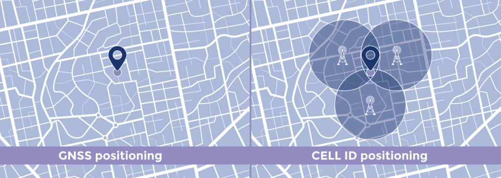
A Cell ID does not provide coordinates by itself. It identifies a specific mobile network cell, and an additional processing step converts this information into an approximate location.
- The device collects data from the main tower and up to four neighboring towers, and transmits it to the server as IO parameters: Cell ID, Location Area Code (LAC), operator code, and signal strength (RSSI).
- The telematics platform sends this data to a geolocation service, such as the Google Geolocation API.
- The service compares the tower data with its database and returns an estimated position.
Positioning accuracy
Cell-based positions are approximate. Many telematics devices transmit data only from the main tower they are connected to at that moment, which alone provides a very imprecise position.
Supported Ruptela devices transmit the main tower data and, in addition, data from up to four neighboring towers. This extra information significantly improves positioning accuracy.
Accuracy also depends on the network. It typically ranges from a few hundred meters in cities, where towers are close together, to several kilometers along rural roads.
Key benefits
- Visibility when GNSS is unavailable. Supports location tracking in underground parking, multi-level garages, warehouses, and areas with GNSS interference, wherever mobile coverage is available.
- More data for better estimates. Devices transmit data from the main tower plus up to four neighboring towers, so the server can generate a more accurate backup position.
- Backup layer for satellite tracking. It serves as a secondary data source that takes over when GNSS is offline.
Cell ID positioning is not designed to replace GNSS, but to cover its blind spots. When satellites cannot help, it provides an independent position estimate, keeping fleets visible when it matters most.
Availability
Cell ID positioning is available on HCV5, Pro5, LCV5, Smart5, Plug5, Eco5, Eco5 Lite, Eco5 BM, and Asset5 devices.
Supported platforms: TrustTrack and Wialon. Other platforms can add support by reading the new IO parameters.
Contact your Ruptela Account Manager to learn more about Cell ID positioning and compatible devices.